

What is the Hikami Kairo?
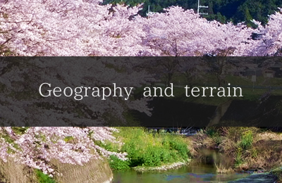
Geography and terrain
Japan sits on the eastern edge of the Eurasian continent.
It is located in Monsoon Asia that receives abundant rain and snow and features a complex terrain and varied climate.
In the middle of Hyogo Prefecture is the Chugoku mountain range (altitude of 1,000 to 1,500 meters) stretching east to west.
This Chugoku mountain range sits between the Setouchi coastal zone on the south with broad plains facing the Seto Inland Sea and the Sea of Japan coastal zone on the north with broad mountain slopes facing the Sea of Japan.
Lowland zone spreading to the north and south between mountains
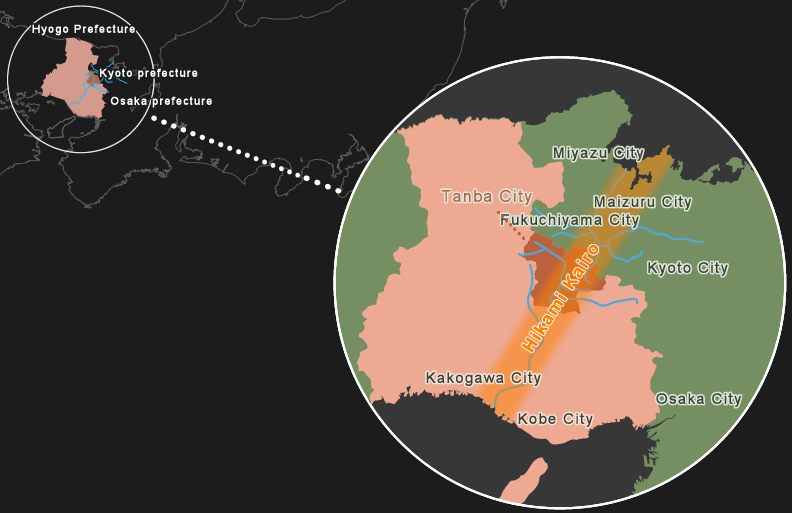
The setting here is the Hikami Kairo, a low-lying zone with its center near Iso, Hikami-cho, Tamba City, Hyogo Prefecture, a mountain valley town located slightly west of the center of the main island of Japan that links the Kako River flowing into the Seto Inland Sea and the Yura River flowing into the Sea of Japan.
The central drainage divide where water splits into two directions
One major characteristic of the Japanese islands is that a mountain zone with mountains ranging from 1,000 to 3,000 meters in height spreads across the median (red line) for as long as 5,000 km.
- Central drainage divide
- 1,000 to 3,000 m altitude around the tops of the mountains
- Water flow
- Water splits in two directions
5,000km(If the central drainage divide stretches in a straight line)
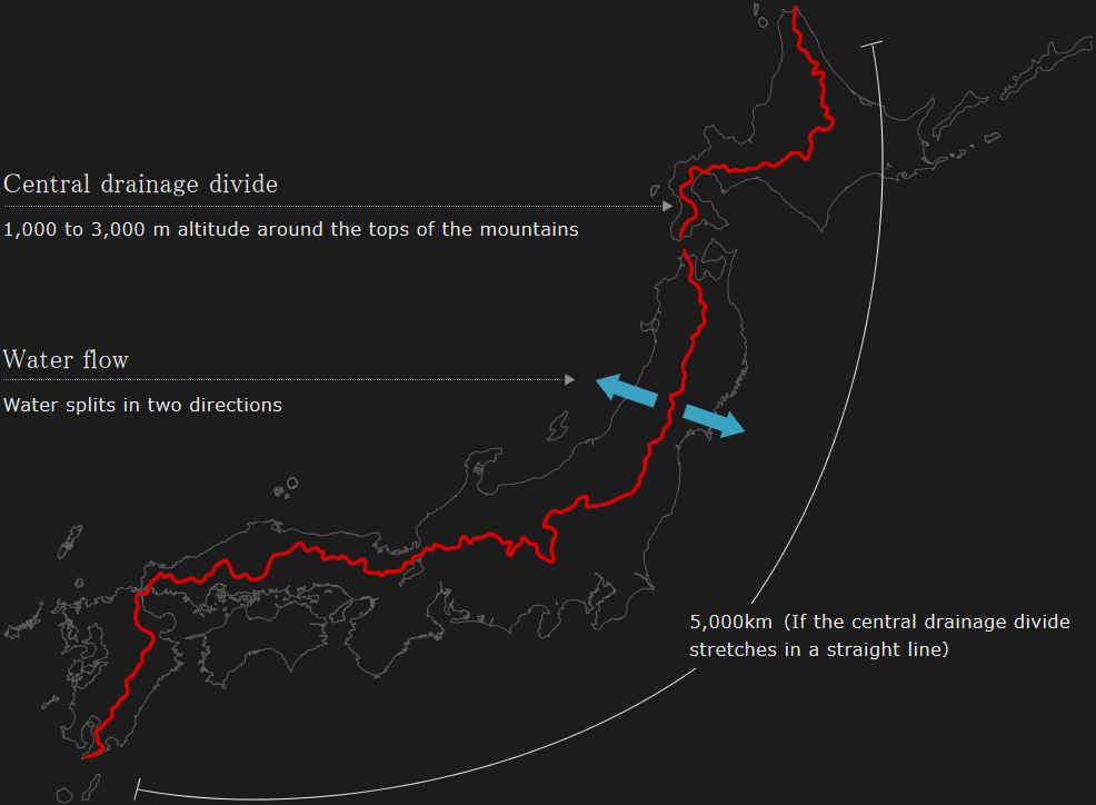
The flow of water splits broadly into the Pacific Ocean side (Seto Inland Sea) and the Sea of Japan side near the top of these mountains (red line), also causing turbulence in the climate and creating a varied climate with different amounts of rainfall and snow cover.
The part around this red line is called the central drainage divide or central watershed as it is the boundary where the water splits into two different directions.
It is like a tall wall separating the Japanese islands into the Pacific Ocean side (Seto Inland Sea) and the Sea of Japan side.
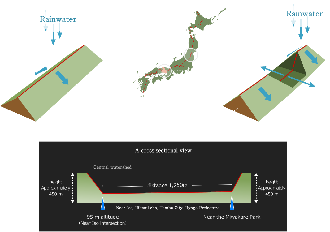
Central drainage divide that has the lowest altitude on the main island of Japan
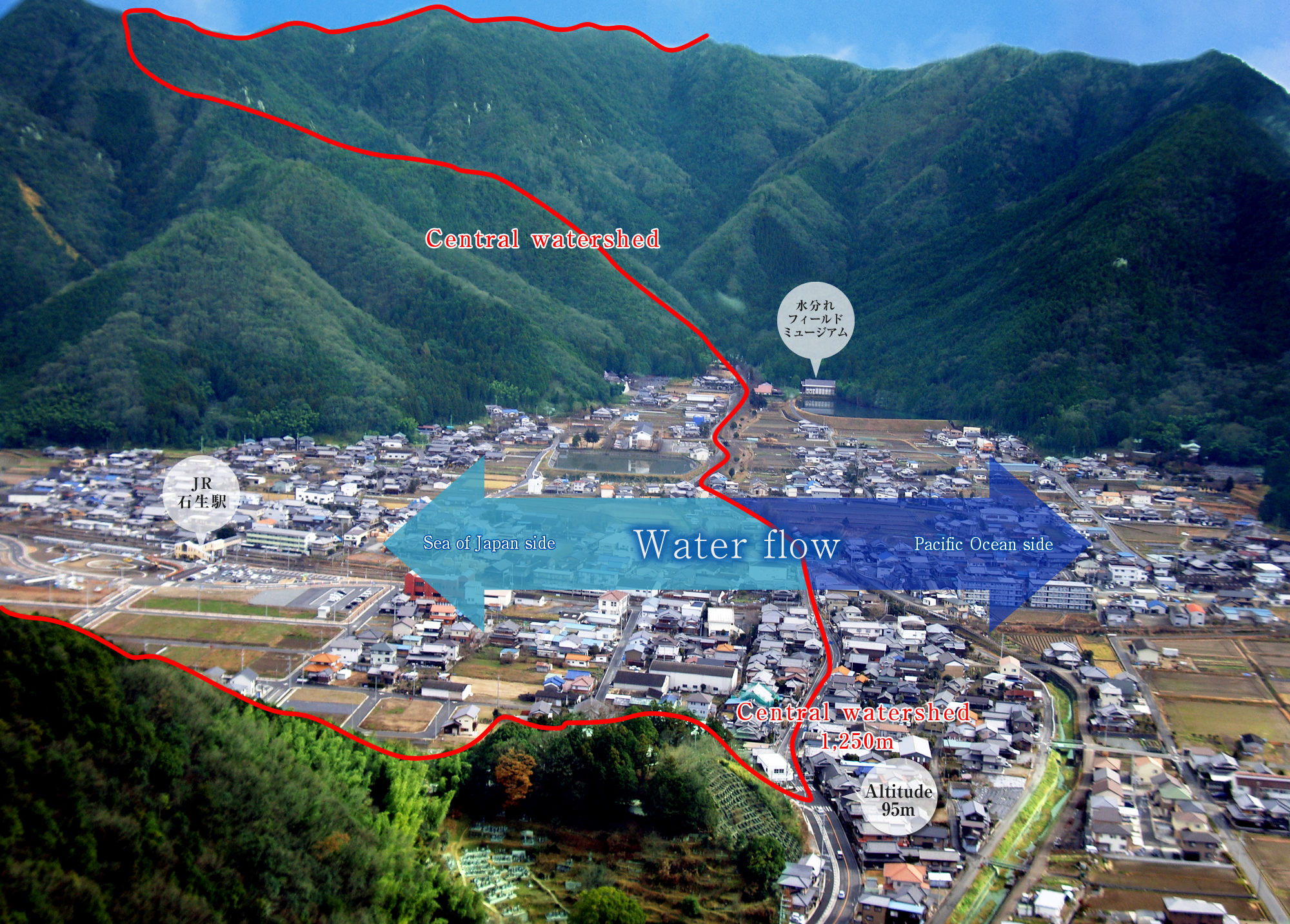
An interesting thing about this central drainage divide (red line) is that it has a very low-lying spot that is a mere 95 m above sea level.
Iso, Hikami-cho, Tamba City, Hyogo Prefecture is called Miwakare in the local area and is the spot on the inland part of the main island of Japan with the lowest altitude.
This lowland is sandwiched between mountains. Water splits into two directions in the middle of the standard rice paddy and rural landscape, heading towards the Kako River on the Seto Inland Sea side in one direction and the Yura River on the Sea of Japan side in the other direction. The lowland zone spreading along these two rivers is the onlya path connecting the Seto Inland Sea and the Sea of Japan.
A place where the winds meet, water is created, and wildlife comes and goes
The warm wind from the Seto Inland Sea and the moist wind from the Sea of Japan blow across this path meeting right around Tamba City in Hyogo Prefecture. The rain and snow carried by these two winds moisten the earth and create a beautiful mist in spring and autumn.
Wildlife from the north and south frequently crosses paths in this geographically unique spot with its abundance of water, leading to the development of rich lifestyles and culture among the people there.
This spot also strongly affects the distribution and differentiation of wildlife and the amount of diversity in species is particularly spectacular on a national scale.
The Miwakare central drainage divide (Iso, Hikami-cho, Tamba City, Hyogo Prefecture) that is a mere 95 m above sea level and is the lowest point in Japan is the center of the lowland connecting the Kako River flowing into the Seto Inland Sea and the Yura River flowing into the Sea of Japan.
This long stretch of low-lying land sandwiched between mountains is a place where diverse wildlife crosses paths, just like the corridor in a palace or temple.
This is why the lowland was given its name, Hikami Kairo.